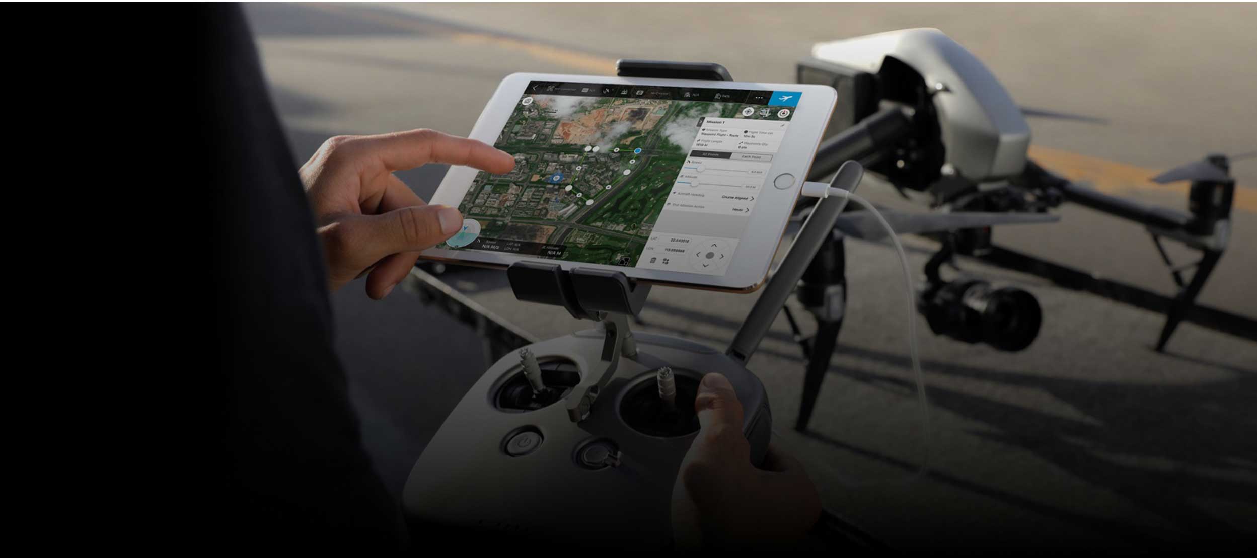
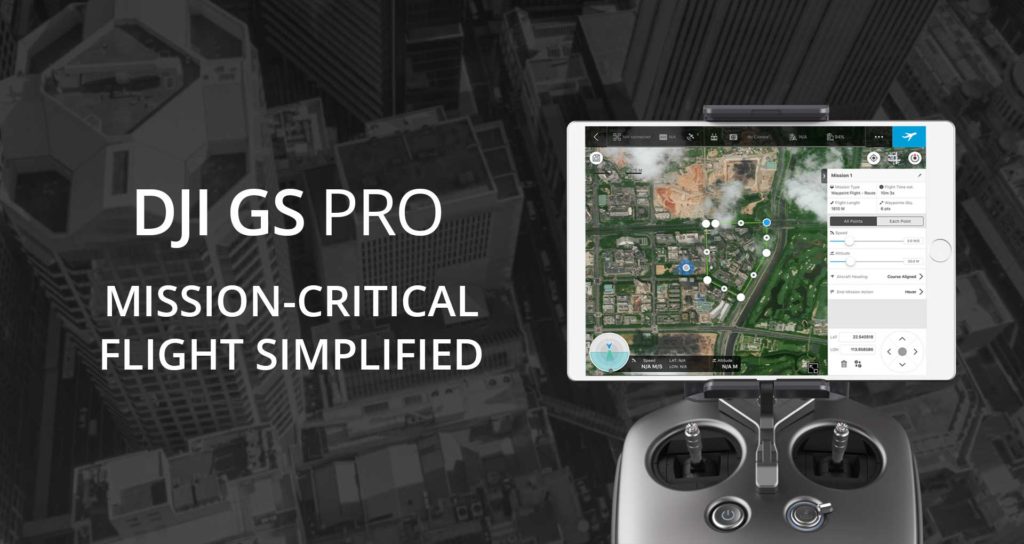
DJI GS PRO | MISSION-CRITICAL FLIGHT SIMPLIFIED
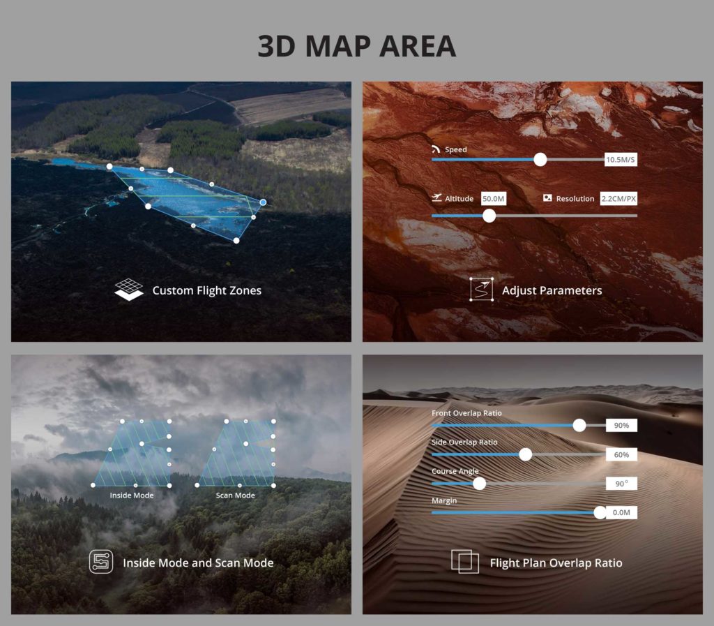
GS Pro automatically generates efficient flight paths after the user has set their required flight zone and camera parameters. The aircraft will then follow this route throughout its mission. The image data captured during these flights can be input into 3D reconstruction software to generate 3D maps, while the mission itself can be saved for re-use.
Adjust parameters including photo overlap ratio, altitude, shooting angle — parallel or vertical to the main flight path — course angle, and margin. Capture images at equal time intervals, equal distance intervals, or to hover at a waypoint during capture。
Two Flight Course Modes are available: Inside Mode, in which the aircraft follows an automatically generated routed within the chosen area and Scan Mode which provides the fastest route to cover a designated area.
To achieve better 3D reconstruction, the default photo overlap is optimized for a range of supported cameras. It can also be independently adjusted.
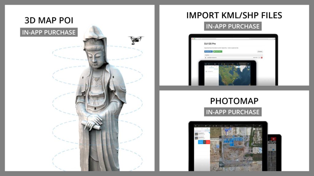
Generate detailed maps of tall structures using 3D Map POI. Simply choose the subject and set a distance between it and the aircraft. GS Pro will then provide relevant parameters including speed and time required to circuit the structure. Images captured can be exported into 3D reconstruction software to create accurate 3D models of the entire building.
Increase your construction mapping efficiency by importing KML/SHP files into GS Pro. KML/SHP files, which contain important geographic information, can be imported into GS Pro via a PC or Mac wirelessly, or directly from within an iPad. After the geometries have been successfully imported, users can swipe left on the geometry list in the Map Panel, and GS Pro will automatically generate a flight mission according to the geometry field, helping users to conduct mapping with accuracy and ease.
The newly-added Photomap function helps users efficiently create aerial photograph-based maps. After users complete an aerial photography mission in the desired area and import the photos into GS Pro, the software will automatically create a composite photo of the area that users can adjust as needed.
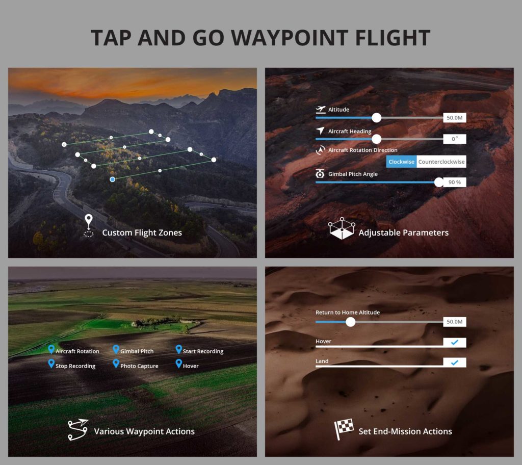
TAP AND GO WAYPOINT FLIGHT
Up to 99 waypoints are available, depending on the needs of each flight.
The altitude, speed, gimbal pitch and aircraft rotation (clockwise or counterclockwise)
at each waypoint can be pre-defined
Each waypoint can have up to 15 consecutive actions, including aircraft rotation, gimbal pitch,
start/stop recording, photo capture, and hover.
After the aircraft finishes its flight mission, it can be set to Return to Home, Hover, or Land.
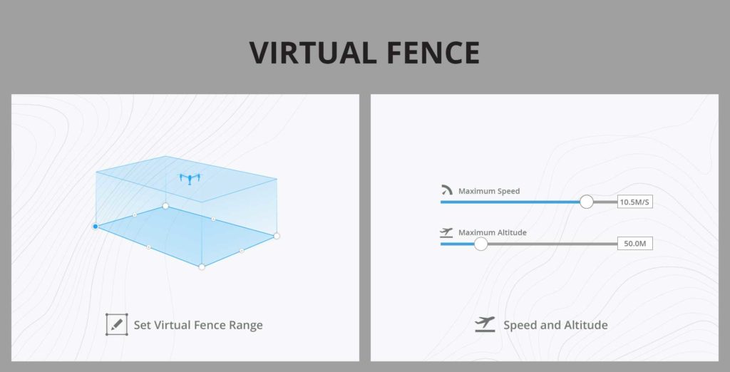
VIRTUAL FENCE
The size and shape of the Virtual Fence is completely customizable. It can be created pre-flight, or fly around the zone to mark boundaries using the aircraft’s GPS coordinates.
Set the maximum speed and altitude for the aircraft when flying inside Virtual Fences.
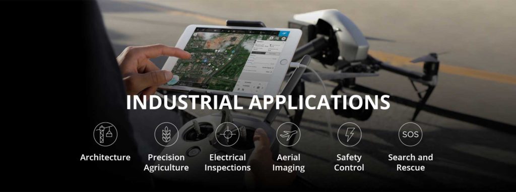
INDUSTRIAL APPLICATIONS
DJI GS Pro is a powerful, convenient and easy to use tool. With just a few taps on an iPad, complex flight routes can be created, giving critical missions added accuracy and reliability. GS Pro is an indispensable tool that is capable of dramatically increasing efficiency in a wide range of industries.
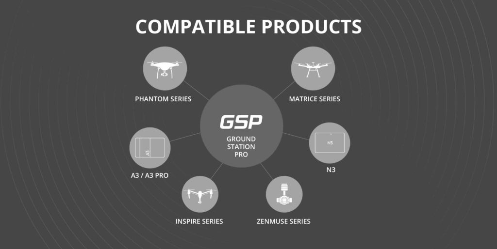
GS Pro is compatible with the following DJI aerial platforms and flight controllers:
Phantom 3 Standard/4K/Advanced/Professional,
Phantom 4/Pro/Advanced,
Inspire 1/Inspire 2,
Matrice 100/600/600 Pro/200,
A3, N3
Phantom 3 Standard/4K/Advanced/Professional,
Phantom 4/Pro, and
Zenmuse X3, X5, X5R, X4S, X5S, Z3, Z30, and XT.